Anno 117 - Layout Tool
A tile-based layout planner for Anno 117: Pax Romana.
Design city districts offline, experiment with production chains, visualise effect radii and street range, then export your finished layout as a PNG.
Features
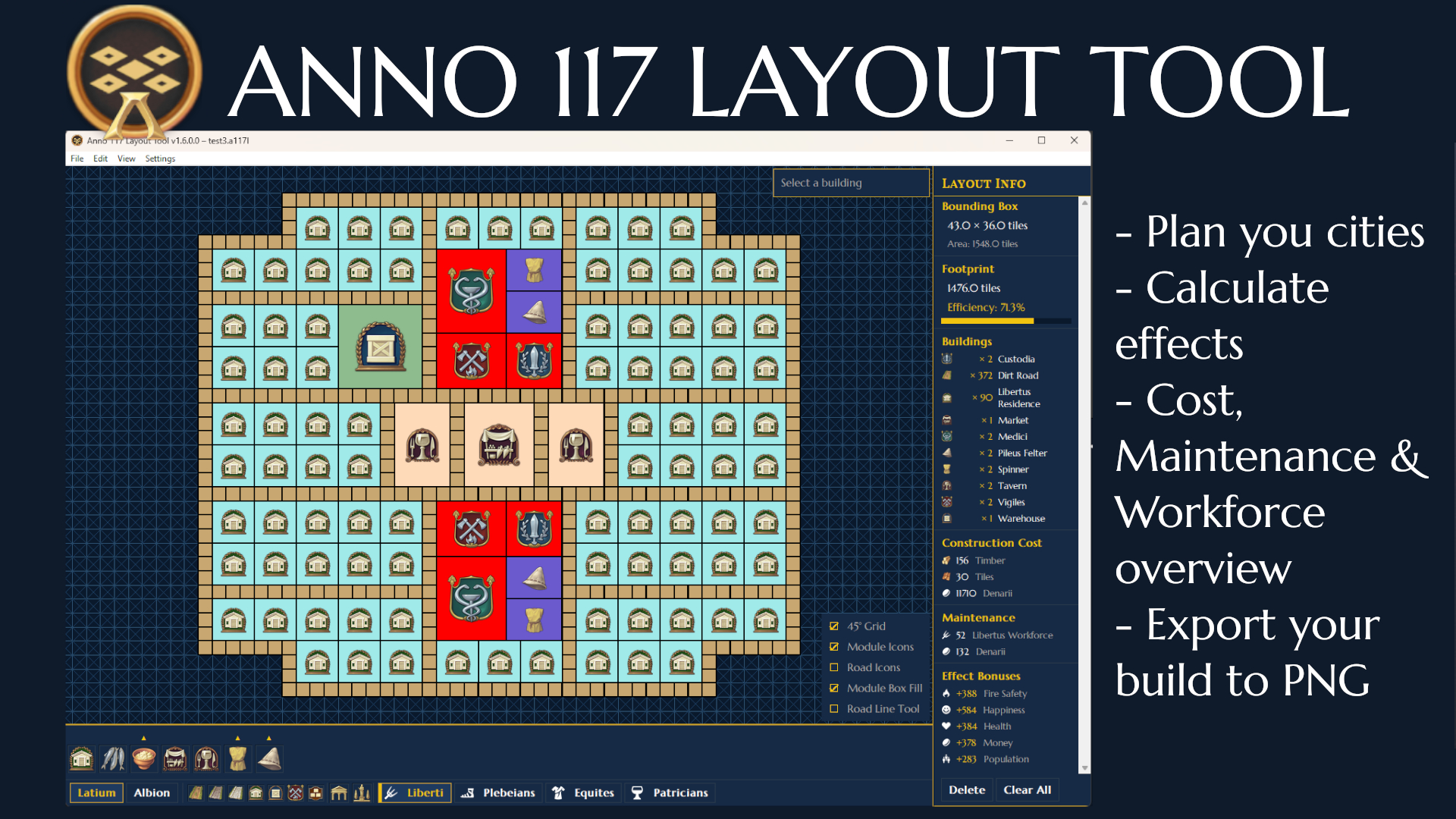
The Layout Tool is a visual city planner for Anno 117: Pax Romana. It gives you a tile-accurate canvas to design and iterate on city districts offline – before committing a single stone in-game.
What you can do with the Anno 117 Layout Tool:
- Design city layouts on both in game supported grids (90° and 45°) with pan and zoom
- Browse every Anno 117 building by region, tier, and category from a built-in menu with full production chain previews.
- Import real island terrain from the game as a colour-coded planning background, or load one of your live savegames to continue planning around an existing city.
- Preview effect radii and street-distance reach in real time as you position service buildings – affected buildings highlight green on the canvas and total attributes, maintenance costs and build costs are calculated on the fly.
- Place roads, farm fields, and modules with drag-to-fill tools; swap an entire road type across the layout in one keystroke.
- Copy, paste, move, and rotate individual buildings or entire groups with full undo/redo support.
- Export your finished layout as a PNG, optionally with a full cost and statistics summary appended.
The Layout Tool runs as a standalone desktop application and does not modify any game files. Island and savegame data is read via the open-source RdaConsole and FileDBReader tools, which the app downloads automatically on first use.